Cyclone Senyar to Form This Week? Coastal Andhra and Tamil Nadu See Rain as Bay System Intensifies

Rain-bearing clouds have begun gathering over south coastal Andhra Pradesh and Tamil Nadu as a developing low-pressure system in the southeast Bay of Bengal continues to intensify. The broad trough linked to this system is pulling strong moist easterlies toward the coast, triggering moderate to heavy overnight and early-morning showers from Ongole and Nellore up to Sriharikota, and along Tamil Nadu's coastline from Chennai and Nagapattinam to Rameswaram. Parts of south Tamil Nadu, including Thoothukudi, Tirunelveli and Kanyakumari, are also receiving rain. These conditions are expected to persist between November 21 and 23, before the system moves deeper into the Bay.

AI-generated summary, reviewed by editors
Cyclone Senyar Likely to Form After November 24
Much of what happens after November 24 will depend on the exact track and strength of the system. Meteorologists say the next formation is extremely likely to intensify into a deep depression or a full-fledged cyclone, which will be named Cyclone Senyar ( Named by United Arab Emirates) if it reaches cyclonic intensity. Forecast models indicate that by November 24 the low-pressure area will consolidate over the central Bay, after which it may strengthen rapidly. Within 48 hours, the system may become a depression over the southwest Bay and could turn into a cyclone around November 26 or 27.
Weather Models Differ Slightly on Timeline
Two major weather models have offered slightly different timelines. The American model GFS expects cyclone formation by November 26-27, with a possible landfall near the north Andhra Pradesh coast around November 29. The European ECMWF model suggests the system could organize into a cyclone as early as November 25.
Weatherman says the behaviour of the system resembles a hybrid of Cyclone Phethai (2018) and Cyclone Montha (2025), which means both intense rainfall bands and strong coastal winds are possible.
Odisha, Telangana Also on Alert
In Odisha, weather scientists believe the state may escape a direct landfall but will still receive widespread heavy rain, especially in southern and coastal districts. The rainfall is likely to continue until November 25, followed by a dip in temperatures after November 26 as winter conditions strengthen. Telangana is also expected to be influenced by the system. East Telangana may receive moderate rain after November 27 or 28, while Hyderabad could witness some showers, although the intensity is not yet certain.
Andaman & Nicobar Under Strong Alert
Meanwhile, the Andaman and Nicobar Islands have already been placed under alert due to rapidly changing conditions in the Bay. Heavy to very heavy rainfall is forecast over Nicobar, with heavy showers expected in Andaman on November 24 and 25. Thunderstorms accompanied by lightning and gusty winds are likely, and sea conditions are deteriorating quickly with winds reaching 35-45 kmph, gusting to 55 kmph. Port Blair has issued Local Cautionary Signal-3, and fishermen have been advised to avoid the Andaman Sea until conditions improve. Island authorities have urged residents, tourists and boat operators to exercise extreme caution, as rising waves may make sea travel risky.
Ferry Services May Be Halted
The Directorate of Shipping Services has warned of possible cancellations and suspensions of inter-island and mainland vessel services. Harbour ferry operations in Chatham, Phoenix Bay, Hopetown, Dundas Point and Bambooflat may also be halted without notice depending on the weather. Officials emphasised that passenger safety will remain the top priority as the system strengthens and moves across the Bay of Bengal.
With memories of Cyclone Montha still fresh, the emerging Cyclone Senyar is being watched closely. Over the next few days, its path and pace will determine how heavily the eastern coast is affected, but early signs point to yet another significant weather event for Andhra Pradesh and neighbouring states.
-
 Gold Silver Rate Today, 30 March 2026: City-Wise Prices, MCX Update On 24K Gold, 22K Gold And Silver
 -
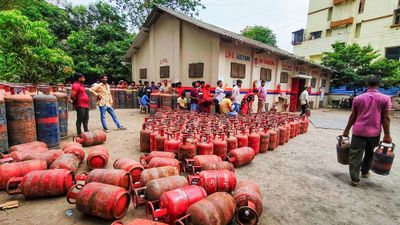 LPG Crunch: Karnataka Brings New SOPs, Makes PNG Registration Mandatory for Businesses
 -
 Hyderabad Gold Silver Rate Today, 30 March 2026: Check Fresh 24K, 22K, 18K Gold And Silver Prices In City
 -
 Opinion Poll For Kerala Assembly Election 2026: Ldf Strength In Kannur And Kasaragod
 -
 Tamil Nadu Polls 2026: Vijay Reveals Rs 645 Crore Assets, Rs 266 Crore in Banks; Know All His Declaration
 -
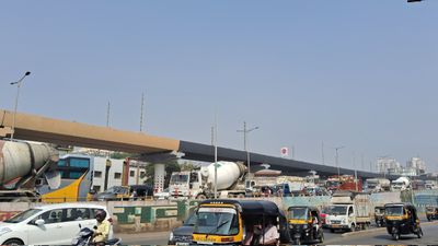 Mumbai Metro Line 9 Set for April 3 Launch, Dahisar-Mira Bhayandar to Get Direct Boost
 -
 Hyderabad Gold Silver Rate Today, 31 March 2026: Gold And Silver See Fresh Movement, Check Latest City Rates
 -
 Gold Silver Rate Today, 31 March 2026: City-Wise Prices, MCX Trend As Gold Rises And Silver Slips
 -
 Rahul Arunoday Banerjee Autopsy Report: Actor Was Underwater For Over An Hour, Sand Found In Lungs
 -
 Thunderstorm Warning In Delhi NCR: IMD Issues Orange Alert Amid Sudden Weather Shift
 -
 Trump Hints At Breakthrough With Iran Amid War Escalation, Calls Recent Move A ‘Sign Of Respect’
 -
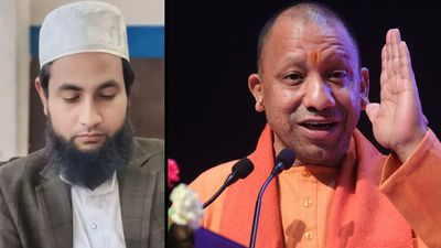 UP STF Nabs Maulana Abdullah Salim Over Controversial Comment On CM Yogi's Mother


 Click it and Unblock the Notifications