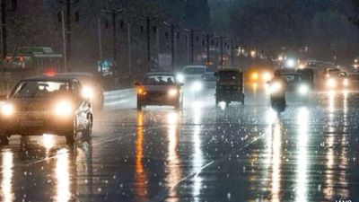
Tamil Nadu Weather: Heavy Rains To Make a Comeback In Chennai?

Chennai could soon be in for another spell of intense rainfall as weather models indicate the formation of a new system over the Bay of Bengal. Meteorologists have warned that a fresh low-pressure area developing over the Southeast Bay may strengthen over the weekend, potentially bringing widespread showers to the Tamil Nadu coast, including the capital city.
According to a statement issued by the Regional Meteorological Centre (RMC), Chennai, "Under the influence of yesterday's upper-air cyclonic circulation over the Southeast Bay of Bengal and adjoining South Andaman Sea, a low-pressure area has formed over the same region at 5:30 a.m. IST today (October 24, 2025). It is likely to move west-northwestwards and concentrate into a depression by October 25, intensify into a deep depression by October 26, and further strengthen into a cyclonic storm over the Southwest and adjoining West-Central Bay of Bengal by October 27 morning."
AI-generated summary, reviewed by editors

Over the past week, several districts in Tamil Nadu have experienced heavy rainfall, with 25 districts reporting heavy to very heavy showers. The affected regions include Ramanathapuram, Pudukkottai, Thanjavur, Tiruvarur, Nagapattinam, Mayiladuthurai, Cuddalore, and Villuppuram, along with Puducherry and Karaikal. Chennai too has received intermittent spells of rain during this period.
Adding to the forecasts, weather blogger Srikanth from the Chennai Weather Blog (COMK) noted that the newly formed system is expected to intensify and possibly move towards the Andhra Pradesh coast. "The system is likely to become a well-marked low within 24 hours, then intensify into a depression and later a cyclone. It may make landfall between Kavali and Kakinada next week. North Coastal Tamil Nadu, including Chennai, could see one rain window on Sunday or Monday," he said.

Meanwhile, the RMC has issued warnings for Cuddalore, Mayiladuthurai, Nagapattinam, Tiruvarur, Thanjavur, Pudukkottai, and the Karaikal region, which are expected to receive heavy rainfall today.
In the last 24 hours, Pallipattu in Tiruvallur district recorded the state's highest rainfall at 15 cm, followed by Nalumukku (Tirunelveli) at 12 cm, and Oothu (Tirunelveli) at 11 cm. Other significant readings came from Arakonam (Ranipet) - 10 cm, Balamore, Pechiparai AWS (Kanyakumari), and Zone 14 Medavakkam (Chennai) - 9 cm each, and Kakkachi (Tirunelveli) at 8 cm. Several stations, including Thiruvalangadu (Tiruvallur), Chittar-I (Kanyakumari), Perunchani Dam, Puthan Dam, and Tiruttani, also registered 7 cm of rainfall each.
With the Bay of Bengal once again turning active, residents across coastal Tamil Nadu - especially in Chennai and its neighboring districts - are advised to stay alert for possible heavy rains and strong winds in the coming days.
-
 Gold Rate Today 31 March 2026: Latest IBJA Benchmark And Tanishq, Kalyan, Malabar, Joyalukkas Rates
 -
 Gold Rate Today 30 March 2026: IBJA Benchmark Rates, Tanishq, Kalyan, Malabar, Joyalukkas Prices
 -
 Gold Silver Rate Today, 30 March 2026: City-Wise Prices, MCX Update On 24K Gold, 22K Gold And Silver
 -
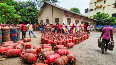 LPG Crunch: Karnataka Brings New SOPs, Makes PNG Registration Mandatory for Businesses
 -
 Hyderabad Gold Silver Rate Today, 30 March 2026: Check Fresh 24K, 22K, 18K Gold And Silver Prices In City
 -
 Opinion Poll For Kerala Assembly Election 2026: Ldf Strength In Kannur And Kasaragod
 -
 Tamil Nadu Polls 2026: Vijay Reveals Rs 645 Crore Assets, Rs 266 Crore in Banks; Know All His Declaration
 -
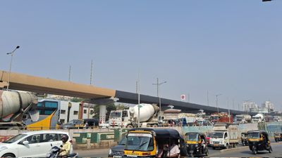 Mumbai Metro Line 9 Set for April 3 Launch, Dahisar-Mira Bhayandar to Get Direct Boost
 -
 Hyderabad Gold Silver Rate Today, 31 March 2026: Gold And Silver See Fresh Movement, Check Latest City Rates
 -
 Gold Silver Rate Today, 31 March 2026: City-Wise Prices, MCX Trend As Gold Rises And Silver Slips
 -
 Rahul Arunoday Banerjee Autopsy Report: Actor Was Underwater For Over An Hour, Sand Found In Lungs
 -
 Thunderstorm Warning In Delhi NCR: IMD Issues Orange Alert Amid Sudden Weather Shift


 Click it and Unblock the Notifications